S P Satyabala, Visiting Scientist, Divecha Centre for Climate Change
The Gangotri glacier is the largest glacier in the Garhwal Himalaya and the source of the sacred river Ganga. Its snout movements have been tracked for more than a century, but little is known about how the rest of its 30-km length moves and changes over time. Here, I have measured for the first time, the surface velocity of the entire Gangotri glacier and tracked its changes over a 20-year period. The results were published recently in the journal Remote Sensing of Environment.
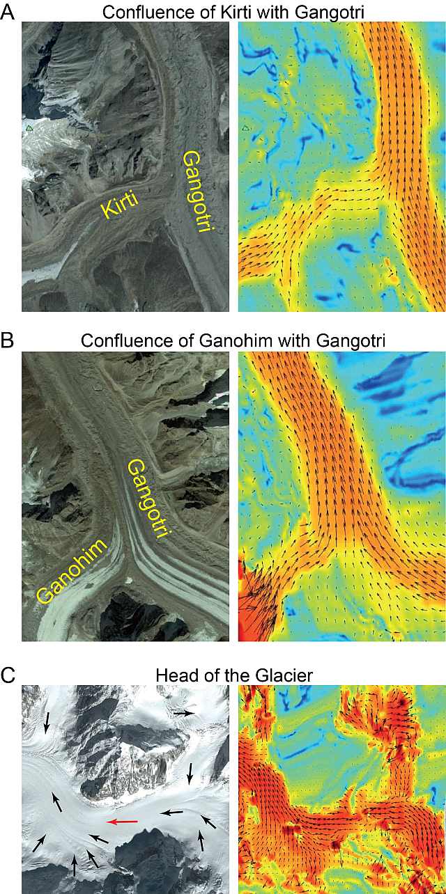
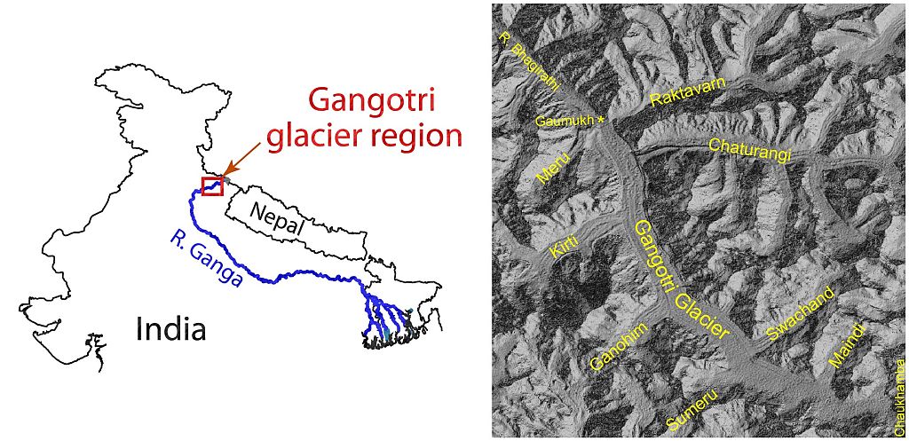
The Gangotri glacier is situated in the Uttarakashi district of the Garhwal Himalayas in Uttarakhand. It is around 30 km long and originates in the Chaukhamba massif, a ridge formed by four mountains. It is fed by several smaller tributary glaciers on either side. The glacier flows northwest and terminates at Gaumukh where its melt-water feeds the Bhagirathi River, one of the main tributaries of the Ganga. The glacier is a traditional pilgrimage site at which devotees flock to take a dip in its icy waters. Its sheer size and inaccessibility has made field studies of the glacier extremely difficult.
 Left:
Overview
of the Gangotri region. Right: Shaded relief map of the
Gangotri glacier with its major tributaries marked. (From
Figure 1)
|
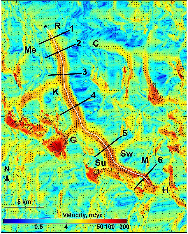
With the advent of satellite imaging, it is now possible to track even tiny movements of glaciers from space. I have used Synthetic Aperture Radar (SAR) data to measure the surface velocity of the Gangotri glacier over a 20-year period from 1992-2011. An example surface velocity map is shown below. I have found that the Gangotri glacier has seasonal variations in its flow, moving steadily in winter and speeding up over the summer as the ice melts. However, there are longer-term trends as well. While the winter velocity has held steady during the entire period of study, the summer velocity showed a peak in 2004 and declined steadily from there on until 2011.
These observations shed light on the complex inner workings of the Gangotri glacier. Glaciers move by sliding along the glacier bed and through internal deformation. The sliding is strongly influenced by the melt-water that penetrates down to the glacier bed. My results show that the intricate network of melt water channels inside the glacier – known as the subglacial drainage system – is evolving across seasons and across years.
Although melting glaciers are iconic symbols of climate change, mountain glaciers such as the Gangotri cannot be thought of as simple blocks of ice. Their internal dynamics are complex and poorly understood, making their response to climate change hard to predict. In the absence of glaciological measurements, surface velocity measurements provide important insights into the internal dynamics of glaciers.
More information
Satyabala SP (2016) Spatiotemporal Variations in Surface Velocity of the Gangotri Glacier, Garhwal Himalaya, India: Study using Synthetic Aperture Radar Data. Remote Sensing of Environment, 181: 151–161 (pdf | supplement | online text)